Key Takeaways
- The Loop is not one road. Parts of it run at about 30 km/h and parts drop to about 9, on the same trip.
- The paved national highway is most of the route. The sections that catch people out are the ones that leave it.
- Going down is harder than going up, everywhere here. That is the opposite of what most riders expect.
- The single roughest stretch is Meo Vac to Du Gia, and it is not on the short route at all.
- The drop is rarely the problem. The surface, the width, and the other people on it are.
Disclosure, before any of this
This site sells you nothing. No tours, no bookings, no affiliate links. I do still own a share of Jasmine Tours, a Ha Giang operator I co-founded and no longer run, so I benefit if you book with them. It matters here because near the end I tell you that one section is hard enough that some riders should take the shorter, cheaper trip instead of the longer one, and the longer one is the one that earns that company more.
“Is the Ha Giang Loop dangerous?” is the question everybody types, and it is the wrong shape. The Loop is not one road. It is a paved national highway with guardrails for most of its length, plus a handful of sections that are nothing like it.
If you want the honest answer to the danger question itself, and what actually goes wrong, that is a different article: the Ha Giang Loop safety guide covers the four things that put riders in hospital. This page is about the roads.
What actually makes a road hard here?
Not the drop. The drop is what photographs well and what your brain fixates on, and it is almost never the thing that catches somebody out.
Four things do.
The surface. Broken asphalt, gravel patched over a repair, water running across the road, rockfall debris after rain. A dry gravel patch is a nuisance. A wet one on a corner is the whole problem.
The width. Most of the mountain road is wide enough for two vehicles to pass, but not comfortably. That phrase is doing a lot of work. It means a truck coming the other way on a blind bend uses your half.
The direction. Down is harder than up, and it is the thing riders get wrong. Climbing, the engine does the work and you have all day to think. Descending, you are braking, leaning, correcting and watching ahead at the same time, and your brakes are getting hot while you do it.
Who else is on it. Gravel trucks, buses, buffalo, and increasingly a lot of other rented motorbikes stopping in places nobody should stop.
Now the number that organises everything below. Across the whole Loop the average riding speed is about 20 km/h, but that average hides the spread: roughly 30 km/h on the good sections and as low as 9 km/h on the rough provincial roads.
Road classification and average speeds from the Wikivoyage Ha Giang Loop page, retrieved 2026-08-08. It also states the QL roads are fully paved with guardrails at the exposed sections, while everything off them is far more variable. I use a non-commercial wiki for this because operators have an interest in how hard you think the road is.
Three times the difference, on one trip. Everything that follows is really just an answer to “which is which”.
Bac Sum: the first climb, and the honest one
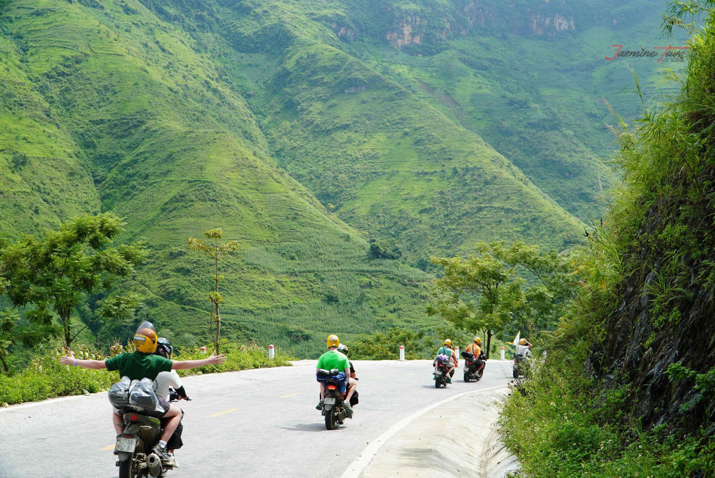
Leaving Ha Giang (Hà Giang) city northbound on the QL4C, the road starts climbing towards Quan Ba (Quản Bạ) almost immediately. One Ha Giang operator’s road guide to the pass describes Bac Sum (Bắc Sum) as around eight kilometres of continuous ascent, the longest unbroken climb on the route (retrieved 2026-08-08). That is an operator’s figure, not a surveyed one, so treat it as the right order of magnitude rather than a measurement.
Technically it is not difficult. It is paved national highway, it is wide, and there is a guardrail where it matters.
What it is, is the first honest thing that happens to you. Eight kilometres of climbing tells you whether you and the bike get on: whether you have found the right gear, whether a loaded bike two-up has the pull you assumed, whether you are relaxed or gripping the bars. Every single one of those answers is useful, and you get them within an hour of setting off.
If Bac Sum feels like hard work, turn round. Not as a failure, but because the road does not get easier and you have lost almost nothing at this point. Whether you should be self-driving at all is the subject of riding this with no experience.
Why is Tham Ma harder going down than up?
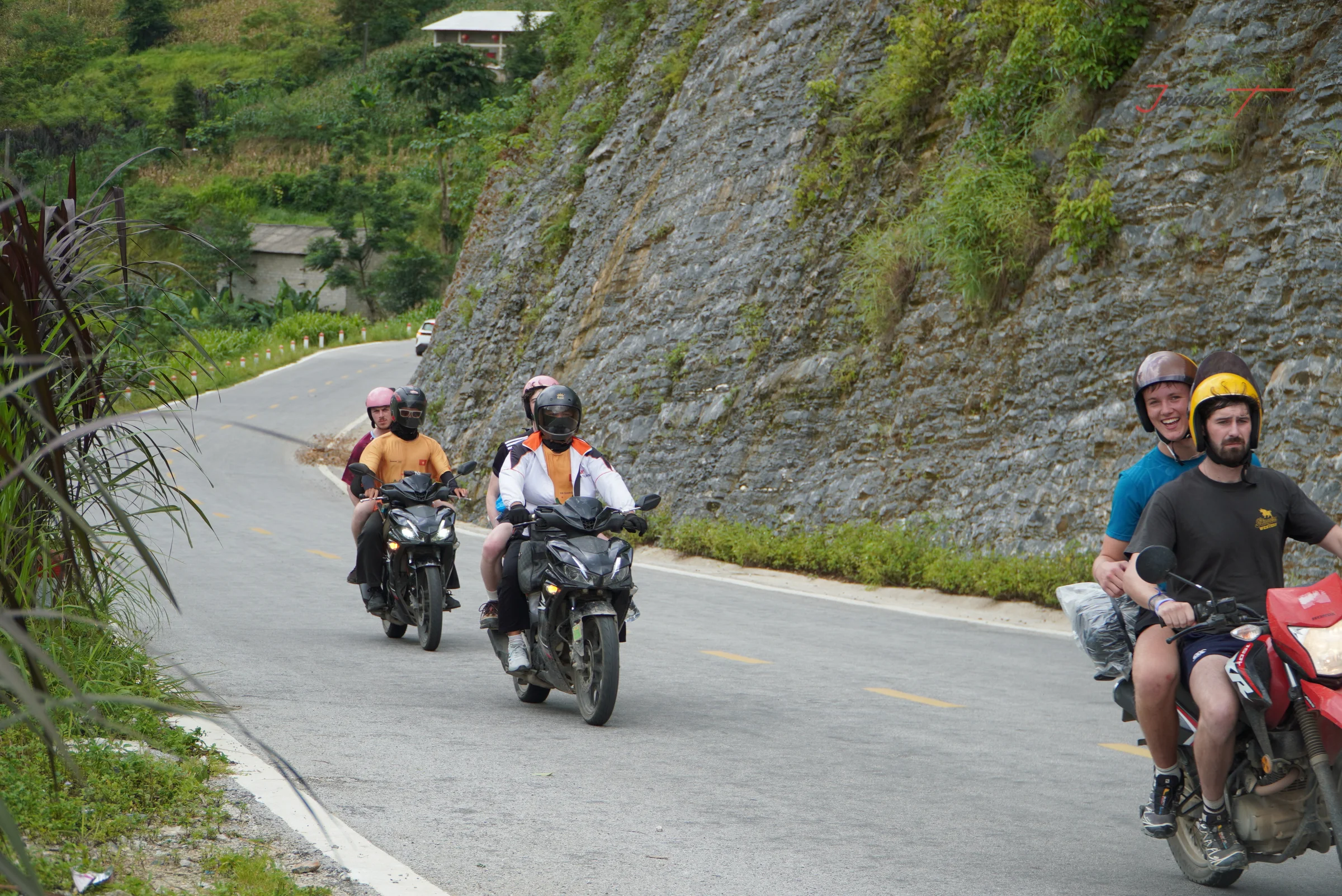
Tham Ma (Thẩm Mã) is the pass everybody photographs, a stack of hairpins folded up a hillside.
First, a note about the name, because you will see it used three different ways. Some sources call the nine-bend slope Doc Chin Khoanh (Dốc Chín Khoanh) and place it on Bac Sum; others call the same feature part of Tham Ma; a detailed riding guide to Tham Ma does not mention the other name at all and says the exact bend count varies depending on where you start counting. I am not going to pretend to settle that. Ride the road; the label is somebody else’s argument.
The road itself is paved and generally in reasonable condition, with cracked sections and loose gravel collecting at the edges, and it is wide enough for two vehicles but not comfortably.
Everybody arrives worried about the climb and gets caught by the descent. Going down, the same guide is blunt that it takes longer than the map suggests, because you are braking, leaning, correcting and watching for oncoming traffic all at once. On a fully automatic scooter you have very little engine braking to help, which is the argument in automatic versus semi-automatic versus manual. Stay in a low gear and let the engine hold you back.
Surface, width and descent detail on Tham Ma from a Ha Giang operator’s riding guide to the pass, retrieved 2026-08-08. I am flagging that it is an operator page rather than treating it as neutral, but they ride it daily and the description matches the road.
Is Ma Pi Leng as dangerous as they say?
Dong Van (Đồng Văn) to Meo Vac (Mèo Vạc) is about 24 km. It is the shortest leg on the whole Loop, and it will take you longer than any 24 km you have ridden.
I am not going to give you an altitude for the pass. Published sources disagree by three hundred metres, and a number that shaky tells you nothing useful about riding it.
Here is what it actually does. The road is cut into the side of the gorge above the Nho Que (Nho Quế) river, narrow, with blind bends and long stretches where there is very little between the edge of the tarmac and a very long fall. Most riders slow right down without deciding to. That is the correct response and you should let it happen.
The exposure is not the real hazard, though. The real hazard is that this is now the most visited section of the Loop, and it is full of people stopping. Vans park half in the lane. Riders brake hard for a photograph they thought of two seconds ago. Someone walks into the road backwards holding a phone.
Ride it early. Before about 9am the tour vans have not arrived and the fog has usually not filled the gorge. It is the same road with half the traffic on it, and it is worth reorganising a morning for.
How bad is the Meo Vac to Du Gia road?
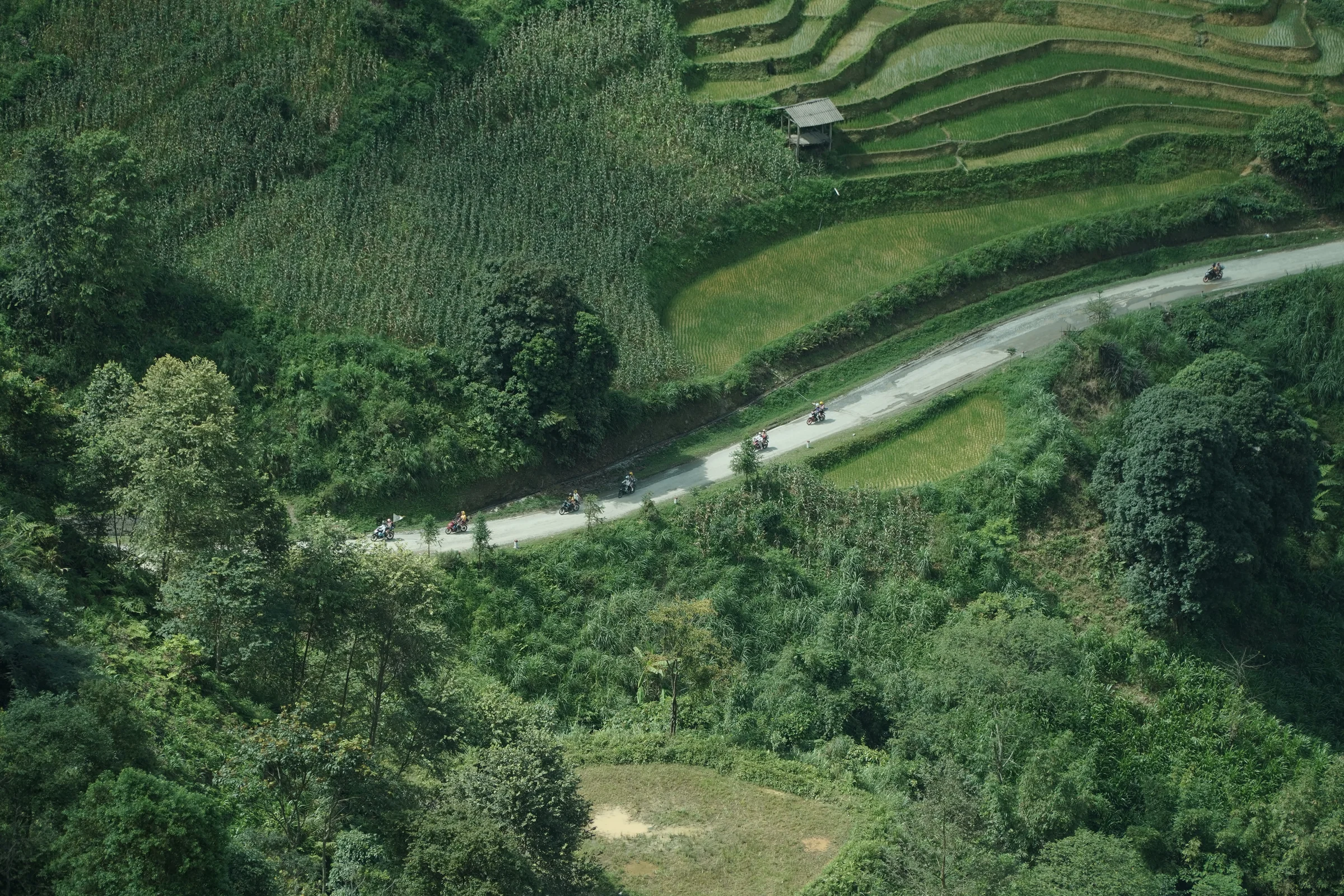
This is the section that earns the word people are searching for, and it is worth being exact about why.
Running south from Meo Vac via Mau Due (Mậu Duệ) and onto the provincial road towards Du Gia (Du Già) is roughly 70 km, and it is a different kind of road from everything above. Broken asphalt, gravel where the surface has been patched, potholes, occasional landslide debris, and stretches that turn slippery after rain. This is where that 9 km/h figure lives.
Do the arithmetic and it is uncomfortable. Seventy kilometres at somewhere between 9 and 15 km/h is not an afternoon. It is most of a riding day, on the worst surface of the trip, and it is usually attempted on day three or four when concentration is already thin.
One piece of good news, and it is recent: the stretches that were under construction through 2024 and 2025 have been finished, and the road is reported to be in decent shape again. Road conditions here change, so treat any description of this section, including mine, as something to re-check rather than a fixed fact.
This is the one section where I would tell some riders plainly not to go. If you are on a fully automatic scooter, if you are two-up with luggage, if it has been raining, or if this is day three and you are tired, the honest answer is that the shorter route exists for a reason. Loose gravel on a descent is where the front wheel goes, and no amount of care substitutes for a bike that suits the surface.
The two short sections nobody warns you about
Neither of these is long. Both catch people, because a short hard section arrives when your guard is down.
The descent to the Nho Que pier. If you go down for the boat, you leave the pass on a narrow access road, drop a long way in a short distance, and then have to climb all the way back out. It is the climb that costs you: a loaded bike, two-up, on a steep short ascent, is exactly how a clutch gets cooked. Go down in a low gear and come back up in one.
The Lung Cu (Lũng Cú) branch. The back roads out to the flag tower are rougher than the QL4C you have been on all morning, and the surface changes without warning you. It is also the first thing cut from a three-day plan, for reasons that are about time rather than difficulty. Which things a short trip drops is covered in the three-day itinerary.
The hardest section is on the trip that earns me more
I should be straight about the shape of the advice above, because it points somewhere convenient for me and I would rather say so than let you notice later.
The roughest section on this page, Meo Vac to Du Gia, is not on the short route. It only appears once you add the Du Gia leg, which is the longer trip, and the longer trip is the more expensive product at the company I hold a share in. So when I write that this section is genuinely hard and that some riders should take the shorter route instead, I am arguing that a chunk of readers should buy the cheaper thing. That is the right advice and it also happens to cost me money, and both of those are true at once.
What I am not doing is telling you the section is worse than it is in order to sound cautious. It is a rough provincial road that thousands of people ride every season, and plenty of them enjoy it more than anything else on the trip. It asks for a suitable bike, a dry day and a rested rider, and if you have those three it is the best riding in the province.
So which sections should you skip?
- Fully automatic scooter: skip Meo Vac to Du Gia. Everything else on the QL4C is fine at a sensible pace.
- Two-up with luggage: skip the Nho Que pier descent, or send one person down. The climb back is the part that bites.
- Riding after heavy rain: skip the provincial roads entirely that day, including the Lung Cu branch. Gravel and water are the combination that puts people down. What each month actually does is in the weather guide.
- Day three and tired: skip nothing, but start two hours earlier. Fatigue is a scheduling problem before it is a riding problem.
- No licence Vietnam accepts: this is not a road question. Sort it first, because it decides your insurance. See whether you need a licence here.
A note on method: only one of my three sources is non-commercial, and I have said in the text which is which rather than presenting operator pages as neutral. They ride these roads daily and their road descriptions are worth having; their estimates of how hard it is are not disinterested. I have given no altitude for Ma Pi Leng because published figures disagree by three hundred metres, and no accident or casualty numbers because no reliable public dataset exists for this road and anyone quoting one is guessing. I was born in this province and I do not run trips on it; the pattern behind what I have written is what travellers report afterwards, and Jasmine Tours took 28,943 guests round this Loop during 2025.
Common questions
What is the most dangerous road on the Ha Giang Loop?
By reputation, Ma Pi Leng. By road surface, the provincial road from Meo Vac towards Du Gia, which is where speeds drop to around 9 km/h. Ma Pi Leng is narrow and busy but paved; the Du Gia road is the one that is genuinely rough underfoot.
Is the Ha Giang Loop road paved?
The national highway sections are fully paved with guardrails at the exposed parts. Once you leave them for provincial roads, the surface becomes far more variable: broken asphalt, gravel patches and landslide debris are all normal.
Is Ma Pi Leng pass hard to ride?
It is not technically difficult, but it is narrow, has blind bends, and is now the busiest section of the Loop. Most incidents there involve other road users stopping badly rather than the drop itself. Ride it before 9am if you can.
How steep is Tham Ma pass?
Steep enough that the descent, not the climb, is what catches riders. It is a stack of hairpins, paved but with loose gravel at the edges, and wide enough for two vehicles only just. Use engine braking rather than riding the brake lever down it.
Can a beginner ride these roads?
The national highway sections, with a suitable bike and an honest pace, are ridden by a lot of people with limited experience. The provincial road towards Du Gia is a different proposition and I would not send a first trip down it, particularly in the wet.
Which direction should I ride the Loop?
Either works, and the surfaces are the same both ways. What changes is which passes you descend rather than climb, and since descending is the harder direction here, it is worth knowing that going anticlockwise puts Tham Ma’s hairpins on your way down.
Learn the four things that make a road hard here, and you stop needing anybody’s list. Look at the surface, the width, whether you are going down, and who else is out there, and the Loop tells you itself which sections deserve your attention.
Written by Jasmine (Thuy Bui), born and raised in Ha Giang. This site sells nothing and carries no affiliate links. I co-founded Jasmine Tours, a licensed local tour operator, and I still hold a share in it; the team there operates it without me. My work now is free advice for travellers and social projects in the province.
Leave a Reply