Key Takeaways
- Ha Giang is the far north of Vietnam, on the Chinese border, about 300 km from Hanoi.
- It stopped being a province on 12 June 2025, when it was merged into Tuyen Quang. The place is unchanged; the address is not, and almost no travel guide has updated.
- The Ha Giang Loop is a road through it, not the thing itself. The area is nearly 8,000 km² and the Loop touches a fraction of it.
- 43 ethnic groups lived here at the last count. The ethnic Vietnamese majority that makes up most of the country is a minority here, at about 12%.
- If you are choosing between Sapa and Ha Giang: Sapa is easier and busier, Ha Giang is further and rougher, and the difference is mostly how much effort you want the trip to cost you.
Almost everything written about Ha Giang is written about a motorbike route through it. That is understandable, because the route is why most people come, and it is also why the place itself gets described in about four adjectives before the article moves on to day one of an itinerary.
This article is about the place. Where it is, who lives there, what changed about it recently that nobody has noticed, and how to decide whether it is the northern Vietnam trip you want.
Where is Ha Giang, and is it still a province?
Ha Giang sits at the very top of Vietnam, sharing a 270 km border with Yunnan in China, roughly 300 km north of Hanoi. It contains Vietnam’s northernmost point, marked by the flag tower at Lung Cu.
Now the part that no travel guide on the first page of Google mentions.
Ha Giang is no longer a province. On 12 June 2025 it was incorporated into Tuyen Quang province as part of Vietnam’s provincial reorganisation. Ha Giang province, as an administrative unit, no longer exists.
Read that carefully, because it matters much less than it sounds and slightly more than nothing.
What has not changed: the mountains, the roads, the villages, the markets, the Loop, the border, the people. Nobody who lives there moved. Nothing you came to see is different.
What has changed: the official address. Paperwork, permits, some maps and some signage now say Tuyen Quang. If you see a form, an insurance document or a mapping app that puts your destination in a province you have never heard of, this is why, and you have not made a mistake.
The reason to know it is not practical so much as protective. When a source you are relying on still describes a province that was dissolved over a year ago, that is a useful signal about when that source was last checked.
Before it was dissolved, the province covered 7,927.55 km² with a population of about 944,000, organised into one city and ten districts: Bac Me, Bac Quang, Dong Van, Hoang Su Phi, Meo Vac, Quan Ba, Quang Binh, Vi Xuyen, Xin Man and Yen Minh. Those district names are still how everybody, including everybody local, talks about where they are. Figures from Wikipedia’s Hà Giang province entry, retrieved 11 August 2026.
Who actually lives in Ha Giang?
This is the part the road-trip coverage skips, and it is the part most people say they remember.
43 ethnic groups were recorded living in the province. The composition is not a rounding error on the national picture, it is an inversion of it:
What that means on the ground: the market you stop at is a Hmong market or a Tay market, not a generic one. The house you sleep in is built the way that group builds houses. The language spoken around you at dinner is frequently not Vietnamese. Many people are bilingual and many older people are not.
It is also the reason to be a careful guest rather than a photographer. Children will come and stand next to you, and the camera you are holding is worth more than a lot of monthly incomes. Buy something. Ask before you take a picture of a person. Do not hand out sweets or money to children, which turns a village into a queue and is the single most reliably damaging thing a well-meaning visitor does.
What is Ha Giang, apart from the Loop?
The Loop is a circuit of roughly 350 km, and the former province is nearly 8,000 km². The road is a thin line drawn through the north-eastern corner of a large, varied place.
The Dong Van Karst Plateau. A UNESCO Global Geopark, which is the actual reason the landscape looks the way it does. Grey limestone, extremely old, extremely eroded, and farmed in the cracks between rocks by people who carry soil uphill in baskets.
The western districts. Hoang Su Phi and Xin Man are terraced rice country, they look completely different from the karst, and the Loop does not go anywhere near them. If you have seen photographs of Vietnamese rice terraces that were not Sapa, they were often here.
The markets. Weekly, rotating between towns, and they are trade rather than performance. This is where the ethnic composition above stops being a statistic.
The border. 270 km of it. It shapes the economy, the road network and what is on sale, and it is why some areas need permits.
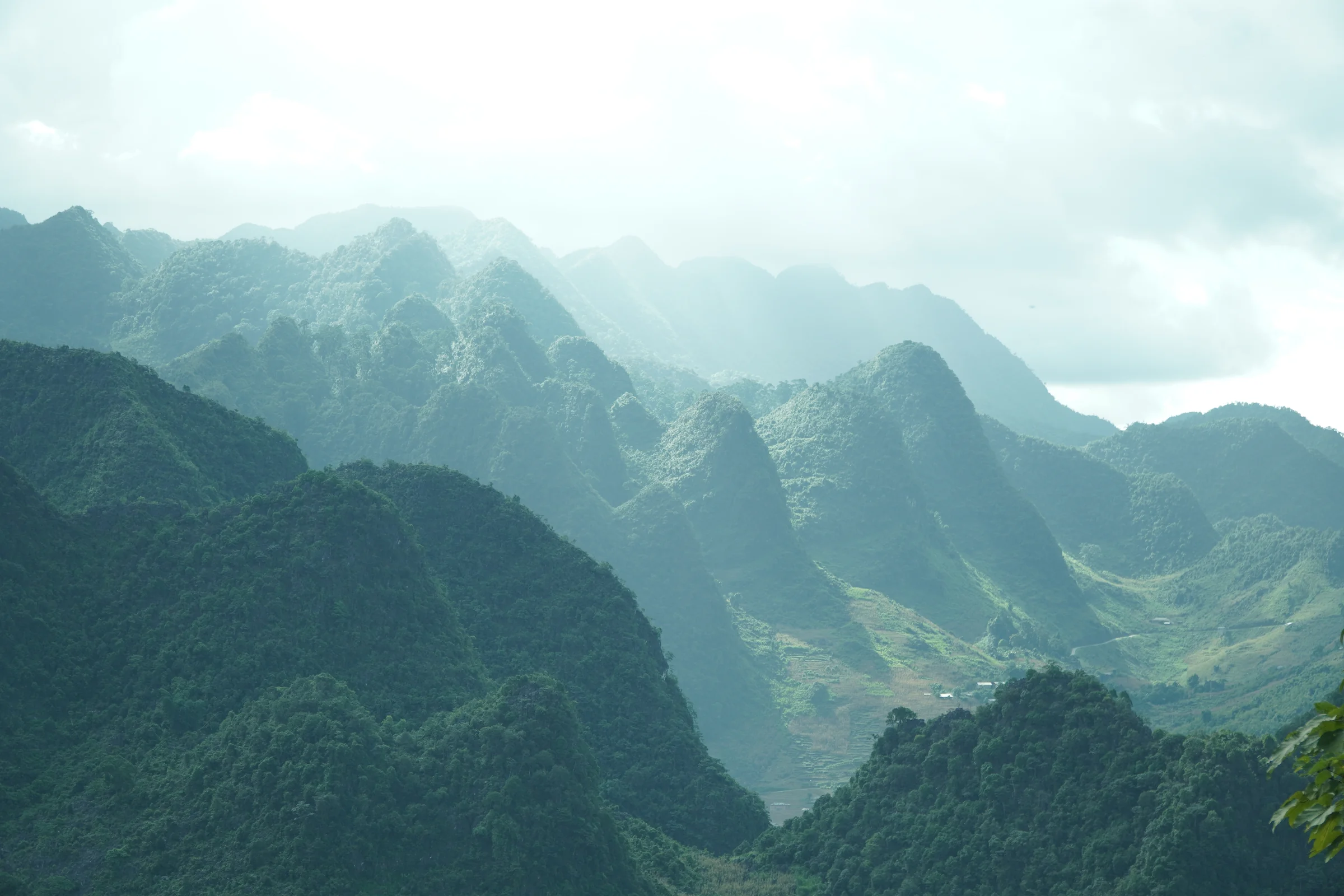
If you only ride the Loop you will have seen a spectacular part of a place, and you will not have seen the place.
Sapa or Ha Giang?
It is the most common question people ask when planning northern Vietnam, and the honest answer starts with what you want the trip to cost you in effort.
Sapa is easier. There is a train and an expressway, the town has real hotels, the trekking is well established and you can do a satisfying version in two days. It is also busy, developed, and the version of hill-tribe tourism there has been running long enough to have hardened into a business.
Ha Giang is further and rougher. Six hours on a bus before anything starts, no railway, fewer options if something goes wrong, and the main way to see it is on two wheels on mountain roads. In exchange it is less packaged, and the ratio of place to product is much higher.
Practical version. Choose Sapa if you have three days total, do not want to ride, and want to walk between villages. Choose Ha Giang if you have four or more days, are comfortable on or behind a motorbike, and would rather the trip be a journey than a base.
They are not substitutes, and doing both is entirely reasonable if you have a fortnight. The best time to visit Vietnam shows which months make the north worth the trip at all.
Do you have to ride a motorbike to see it?
No, but the alternatives are narrower than for anywhere else in Vietnam, and it is worth being straight about that.
You can ride pillion behind a local rider, which is what most visitors who cannot or will not ride actually do. You can hire a car with a driver, which works and costs more and puts glass between you and the thing you came for. There are jeep tours. What does not really exist is a public-transport version, because the villages are spread across mountains and the buses that connect them run on the schedule of people who live there.
The decision that matters most is not which vehicle but whether you ride yourself. Self-drive versus an easy rider works through it honestly, including the cases where self-drive is a bad idea. If you have never ridden before, riding without experience is the one to read first, and what actually goes wrong up here is the one people skip and should not.
Getting there is its own small problem, covered in Hanoi to Ha Giang. And if you are working out when, Ha Giang’s weather month by month is the local version rather than the national one.
Common questions
Is Ha Giang still a province of Vietnam?
No. Ha Giang province was incorporated into Tuyen Quang province on 12 June 2025 as part of Vietnam’s provincial reorganisation. The area, the roads and the Ha Giang Loop are unchanged, and everyone locally still calls it Ha Giang. Only the official administrative address changed.
What is Ha Giang famous for?
The Dong Van Karst Plateau, a UNESCO Global Geopark of grey limestone mountains; the Ha Giang Loop motorbike route; the Nho Que river running through a deep canyon; Lung Cu, Vietnam’s northernmost point; and the ethnic minority markets, in a place where 43 ethnic groups live and the national Vietnamese majority is only the fourth-largest group.
How far is Ha Giang from Hanoi?
About 300 km, which is roughly six hours by sleeper bus or limousine van. There is no train and no airport, so the road is the only way in.
Which is better, Sapa or Ha Giang?
Neither is better; they suit different trips. Sapa is closer, easier to reach, more developed and better for trekking on foot over two or three days. Ha Giang is further, rougher and less packaged, and seeing it properly means being on a motorbike for several days. If you have a fortnight in the north, both fit.
Do you need a permit to visit Ha Giang?
Not for the main route and towns. Some areas close to the Chinese border have required a border-area permit, usually arranged cheaply and quickly through a hotel or tour operator in Ha Giang city. Rules around border zones change, so confirm locally rather than trusting an article, including this one.
A note on sources and on standing. I was born in Ha Giang, which gives me some authority about the place, the seasons and the people, and none at all about riding technique or mechanics. The administrative, demographic and geographic figures here are cited to Wikipedia’s province entry rather than to memory, because a merger date and an ethnic breakdown are exactly the kind of thing personal familiarity gets subtly wrong. Where this article says something you can check, check it.
Leave a Reply